
Walk a Middleton Street by Address
A sound street directory begins with one normalized Middleton address, not a list of assumed occupants. Keep the house number, direction, street name, type, and unit distinct. Search Access Dane Land Records first. Its parcel card connects an address to a parcel identification number, municipality, tax owner, legal description, assessment links, and map location. An owner name is useful, but it does not prove residence. A mailing address may point elsewhere, and renters may not appear in the ownership roll.
Move through independent sources in a fixed order. This prevents similar street names, condominium units, and postal-city mismatches from being merged. Put a date beside every result.
- Enter the address in Access Dane without the municipality. Save the PIN, situs address, owner field, and legal description.
- Open DCiMap and inspect nearby parcels, zoning, aerial imagery, and the city boundary.
- Use MyVote for an authorized personal registration check. Public voter-list access follows separate Wisconsin rules.
- Search the current owner in the Dane County deed index, matching the legal description and document number.
- For older occupancy, consult reverse directories, maps, and dated local-history sources.
The result distinguishes who owns land, who receives tax mail, who appears in a dated directory, and what the public record cannot establish.
Search Middleton Parcels Precisely
Access Dane accepts partial address text and uses type-ahead suggestions. County help says to omit the municipality from an address query. If quick search fails, the advanced form can use a legal description, plat, certified survey map, or condominium unit. This helps when a new number does not appear in an old instrument.
| Middleton search field | Input | Useful detail |
|---|---|---|
| Street address | Number, direction, name, type | Partial text works; omit municipality |
| Owner | Last or business, first, middle | Contained-in searches find partial names |
| Parcel number | Full or partial PIN | Dashes and prefixes are accepted |
| Survey location | Township, range, section, quarters | Useful after an address change |
| Plat or CSM | Name, number, block, lot | Connects subdivisions to legal descriptions |
| Condominium | Building and unit | Separates units at one street address |
The county screen shows these distinct search paths. Review the Access Dane form before entering a Middleton street.
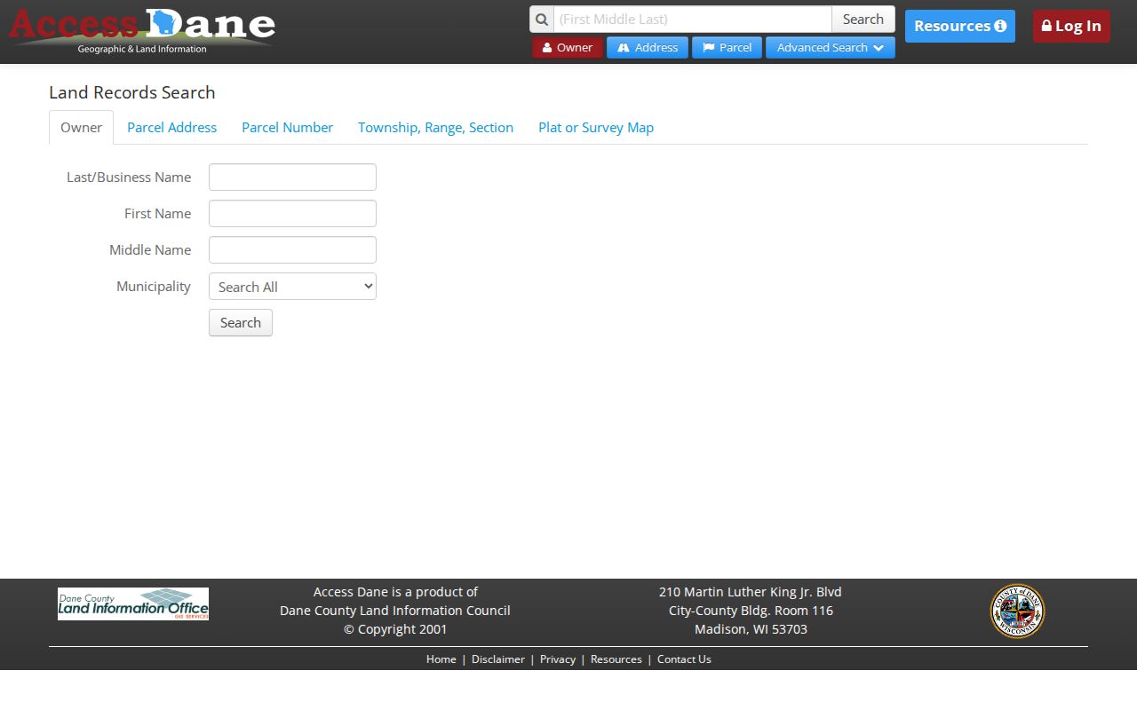
The form makes clear that address, parcel, survey, plat, and unit searches are separate routes to a land record.
Middleton Street Record Terms
Land systems use words that matter when a street directory result is checked. They prevent a tax mailing field or map label from being stated as a household fact.
- Parcel
- A defined unit of land tracked with a county PIN.
- Situs address
- The physical parcel location, distinct from an owner's mailing address.
- Plat
- A recorded map laying out lots, blocks, streets, and easements.
- Criss-cross directory
- A directory arranged by address or phone rather than only by surname.
A postal city, situs address, municipal boundary, and owner mailing address can differ. Name the field that supplied a location.
Middleton Records Indexed by Street
No single Middleton street directory covers every resident. Several address-keyed systems answer narrower questions. County tools establish land identity and title. City permits document work. Historical sources supply dated occupant clues.
| Record Set | Keeper | What It Shows | Access |
|---|---|---|---|
| Property / tax roll | Dane County Land Information | PIN, situs, owner, legal description | Access Dane |
| GIS parcel map | Dane County | Parcel shapes, zoning, aerials | DCiMap viewer |
| Deeds and liens | Dane County Register of Deeds | Recorded parties and instruments | Tapestry, Laredo, counter, mail |
| Voter information | Wisconsin Elections Commission | Authorized registration check | MyVote or lawful list request |
| Building permits | Middleton Building Inspection | Work and inspection history | Portal or records request |
If a portal omits an older file, contact the custodian, visit the office, mail a request, or ask archive staff. Online silence is not proof that no record exists.
Follow Middleton Street Deeds
The Register of Deeds search hub offers Tapestry EON for occasional users and Laredo Anywhere for frequent users. Its online index begins in January 1975. Search the owner from the parcel card, then match legal description, recording date, and document number. Deeds convey title; mortgages secure debt; satisfactions record a release; easements grant use rights; plats explain lot boundaries.
Tapestry needs exact last-name spelling. A first-name prefix such as JAN can broaden results, and county instructions say not to use middle initials. Search details are free after a result, but the stated charge is $8.75 per search and $1 per image page. Failed searches are not charged.
The Tapestry instructions show the name route used after an address has been tied to an owner.
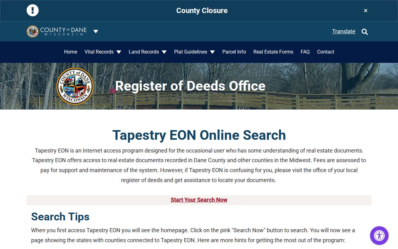
This screen belongs after the parcel search because a party index alone cannot prove which property a same-name document concerns.
Uncertified copies cost $2 for the first page and $1 for each added page; certification adds $1 per document. Counter requests need a party, address or legal description, and approximate year, with cash payment. Mail needs a document number or volume and page, year, page count, money order, and stamped envelope. The county advises about two weeks.
Middleton Permits Add Street Dates
Middleton Building Inspection routes building, electrical, plumbing, HVAC, zoning, demolition, stormwater, occupancy, and enforcement files. A permit may date an addition, repair, use, or demolition. It may name an applicant, contractor, parcel, or owner, but filing a permit does not prove residence.
Start online. For a missing file, contact the department or submit the city open-records form with full address, record type, and date range. Wisconsin Public Records Law requires a reasonably specific request, and actual direct costs may apply.
Map Middleton Streets Across Borders
DCiMap adds parcel shapes, zoning, environmental layers, aerials, and print or export tools. It shows whether nearby numbers lie on separate lots and whether a road crosses a city edge. A map is spatial evidence, not a deed.
The Middleton maps and plans page adds official maps, FEMA panels, growth areas, and intergovernmental agreements. No verified citywide street-renumbering list was found. When an old number fails, ask Planning, the Clerk, or county Land Information for a crosswalk, annexation map, or plat amendment.
Middleton's documented intergovernmental agreements add useful date and place checks near the city edge. The maps page identifies agreements with Town Middleton in 1994 and 2001, Springfield in 2004 and 2009, and Westport in 1998. An address near one of those borders should be tested against the agreement or official map that applied at the record date. A current city outline cannot by itself settle which office held an older permit, assessment, or planning file.
Subdivision records offer another route when the street name is new. Access Dane can search a plat name, CSM number, block, lot, outlot, condominium building, or unit. A certified survey map, often shortened to CSM, records a surveyed division or boundary. Match that map to the deed's legal description and the parcel polygon. This method can connect an earlier lot description to the present Middleton number without assuming that both labels existed at the same time.
For a usable map citation, save the layer name, map date, parcel PIN, scale, and export date. Historical aerial imagery should also carry its flight year. Those details let another researcher distinguish a boundary shown by the county from a conclusion drawn by the person reading it.
Peatsville Beneath Middleton Streets
Middleton's official history recalls the Peatsville nickname, peat harvesting, the railroad arrival in 1856, and city incorporation in 1963. These shifts guide a search. Early land may use legal descriptions before modern numbers. Railroad growth adds deeds, plats, photos, and directories. Later development adds subdivision records, permits, zoning, and minutes.
Do not claim that one parcel was peat land from the nickname. The city history gives context; parcel-level statements still need maps and land records.
Note: Older Middleton evidence may be indexed by legal description rather than the street number used today.
Read Older Middleton Streets
Reverse directories organize listings by address or phone. The Historic Madison guide describes Madison and Dane-area collections, including digitized runs from 1858 through 1921 and later physical holdings, but it does not prove full Middleton coverage. Record publisher, year, scope, page, and entry before naming an occupant.
The collections are detailed on the Middleton city directories page. Address research can also use Middleton Public Library, Rowley House Museum, Dane County Historical Society, Wisconsin Historical Society, and UW collections. Confirm service hours before visiting.
Middleton Street Labels Can Conflict
ZIP 53562 is the primary Middleton postal test, while nearby postal labels overlap surrounding areas. USPS routing, city limits, parcel municipality, and Middleton's eight aldermanic districts answer different questions. Verify mail through USPS ZIP Lookup, then check jurisdiction through Access Dane and city maps.
MyVote asks for street address, unit, city, and ZIP. It serves a person checking registration, not a street directory export. Public list access follows Wis. Stat. §6.36; protected addresses, birth dates, license or Social Security data, and accommodation data are restricted.
Limits of Middleton Street Directories
A parcel card proves a tax record, not who sleeps at an address. A deed proves a recorded interest, not a household. A directory is tied to its edition. No system found here supplies every renter or household member. State the source, date, and role. Use “tax owner” for Access Dane and “listed occupant” for a dated directory.
Treat no result as unknown. A changed number, spelling, source gap, protected address, or out-of-city postal label can explain it.
Lawful use. Use Middleton address records only for lawful personal research. Never publish a protected address or use records to stalk, harass, threaten, or harm anyone.