
Middleton Neighbors by Official Source
No single public roll identifies every household on a Middleton block. The sound method combines a current parcel map, the county property roll, recorded land instruments, public civic information, and older directories when history matters. Each source proves a different fact. A parcel polygon shows where a lot lies. A tax field names the recorded owner for its effective date. A deed supports title, while an association page documents a public organization rather than its private membership.
| Source | What It Shows About a Block | Access |
|---|---|---|
| Dane County DCiMap | Adjacent parcels, streets, zoning, aerials and map layers | Free interactive viewer |
| Access Dane | Parcel number, situs, owner-tax field and land links | Free current search |
| Register of Deeds | Easements, deeds, plats and certified survey maps | Online index from January 1975; office and mail fallback |
| Middleton civic programs | Neighborhood districts, public officers, meetings and groups | Public pages and records requests |
| Historical directories and maps | Past address order, household clues and block form | Library, archives and selected digital collections |
The word “owner” should stay attached to the tax or deed record. It is not a synonym for occupant or resident. A parcel owner may receive tax mail elsewhere, and a deed may reflect a trust or entity. Record the source date and role before drawing any conclusion about Middleton neighbors.
Open Middleton's Parcel Block
Dane County DCiMap is the spatial starting point. Locate the known parcel, then inspect the polygons touching it or facing it across the street. The viewer supports parcel, zoning, aerial, park, wetland, lake, stream, soil, elevation, and other layers, along with print and export tools. Preserve the layer name and imagery date because an aerial and a current ownership roll may describe different moments.
The successful project capture comes from Access Dane Land Records Search, the linked parcel-record companion to the map.
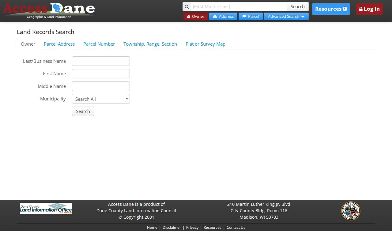
The search screen supports owner, parcel address, parcel number, township-range-section, plat, survey map, and condominium routes. Use those keys to confirm each selected polygon rather than reading a name from map position alone.
Owners Are Not Always Neighbors
Access Dane can display an owner or tax mailing field, parcel situs, assessment and tax links, zoning, and the legal description. The situs is the physical parcel address. The mailing field is where tax material goes. If the two differ, that is not evidence of wrongdoing or even proof that the owner lives away from the property.
A resident may also be absent from the ownership roll. Public utility customer data was not found as an open household source, and it should not be treated as one. For neighborhood research, label a person only by the role the record proves: recorded owner, deed party, public officer, applicant, or historical directory entry.
Identity check. A tax-owner field, voter match, or court result alone does not prove that someone currently lives on a Middleton block.
Map Middleton Neighbors Parcel by Parcel
Keep the block small enough to verify every lot. A practical boundary is the parcels that share a line with the starting lot, plus the parcels directly across the street. Expanding to an entire road changes the task; the Middleton street directory owns that wider street-by-street workflow.
- Normalize the starting street, direction, type, and unit. Access Dane says an address may be partial and should omit the municipality.
- Open its parcel in DCiMap. Record the parcel number, legal description, municipality, map date, and selected layer.
- Select only adjacent and facing parcels. Carry each parcel number back to Access Dane.
- Record the owner field and its date as an ownership clue, not an occupancy finding.
- If a shared drive, access route, or lot boundary matters, search the deed index for an easement, plat, or certified survey map.
The result is a block map with cited parcels and dates, not a contact list. That format is enough for land history, a neighborhood planning question, or a shared-boundary issue without repeating private details.
Middleton Neighborhood District Contacts
The city does not publish a complete official list of neighborhood associations or HOA members. Its most concrete block-level civic system is the Middleton Police neighborhood program. The 2022 annual report describes 12 districts with an assigned neighborhood officer. The public program supports community contact and problem solving without exposing a household roster.
The Middleton Police Programs and Outreach page shows the public entry point for those neighborhood contacts.
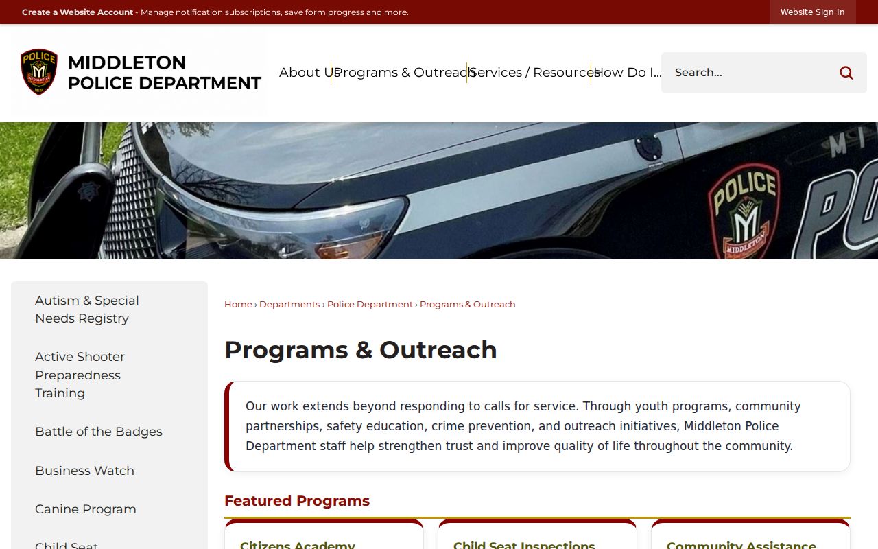
This program supplies a city contact by district, not the names or details of private residents on the block.
Neighborhood Districts
Middleton Police Programs and Outreach
Public district and program contacts; no resident list.
City Public Bodies
Committees, commissions, agendas, and minutes
Use a named role and meeting date.
Planning Route
Planning and Community Development
Subdivisions, annexations, zoning, and association leads.
Recorded declarations or plats may identify an HOA contact when a public directory does not. Do not assume that membership names are public. Ask the city or the organization for the appropriate public contact, not a private roster.
Community Records Around Middleton Neighbors
Several public groups add context without becoming resident directories. The Downtown Middleton Business Association is named on the city's Community Development page and can explain downtown commercial addresses. Friends of Pheasant Branch Conservancy can connect a place with public programs or events, but the research found no official public member roster. City committees publish members, agendas, and minutes tied to public roles.
The Middleton Chamber maintains a member-business directory. It should remain a business source, not be recast as evidence that a named person lives near the listed address. Religious, fraternal, and civic clubs may appear in library or historical collections, but no official Middleton membership index was found. A records gap should be stated plainly.
Middleton Neighbors Across Civic Lines
People on the same visible block can fall into different civic or postal layers. Middleton has eight aldermanic districts, while its main postal code and edge ZIPs follow other boundaries. A Madison or Waunakee postal label does not settle the parcel municipality. Compare Middleton's official maps, DCiMap, USPS, and the election map for the date being studied.
The captured Middleton Maps and Plans resource keeps the city's boundary and planning sources together.
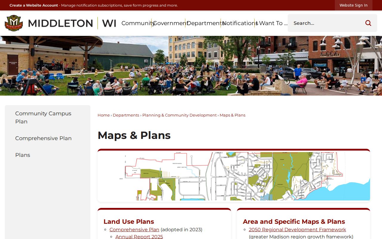
Use its official-map date and named layer when explaining why two nearby parcels fall under different civic records.
The city's map page also identifies agreements with Town of Middleton, Springfield, and Westport. Those records can explain annexation and planning context near an edge. They do not prove a person's residence. A ward result should route a civic question to the right clerk, official, or meeting record while leaving private voter identifiers out of the summary.
Official Middleton Neighbor Records Compared
Official sources are narrower than commercial neighbor-search products, but their custody, dates, and field meanings are easier to document. Private products may merge old address, phone, and household material without showing why two records were joined. They can be stale, and no named commercial service is needed for this block method.
| Source type | Best use | Main caution |
|---|---|---|
| County parcel and deed records | Owner, parcel, legal boundary, shared instrument | Ownership does not prove occupancy |
| City maps and civic records | District, permit, planning, and public role | Tie every result to a date |
| Commercial compiled data | Possible lead only | Merge errors, old data, unclear sources |
When an official record conflicts with a compiled listing, return to the custodian. Correct parcel errors with Land Information, election errors with the clerk or Wisconsin Elections Commission, and deed questions with the Register of Deeds.
Privacy Limits for Middleton Neighbors
Public access is not permission to collect every available detail. Wisconsin voter records restrict birth dates, driver-license and Social Security number data, accommodation information, and protected addresses. MyVote is designed for an individual's own identity match, not a public block browse. Utility customer and delivery data should not be treated as public household directories.
Wisconsin Safe at Home assigns substitute addresses and forwards mail for eligible participants. Confidential electors' actual addresses are protected from ordinary inspection and copying. Never try to reverse an assigned address by combining parcel, voter, court, directory, or organization clues. Stop at the protected route.
Lawful use. Research Middleton neighbors only for a lawful personal or civic purpose. Never use block records to watch, harass, intimidate, or expose anyone.